

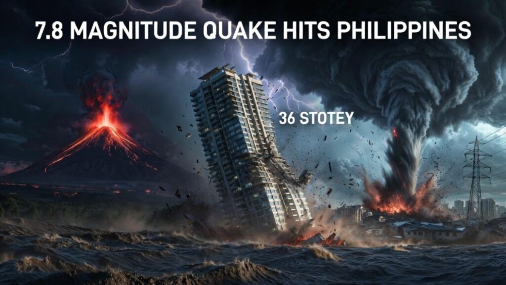
Powerful 7.8-Magnitude Earthquake Devastates Southern Philippines — and the world watched in horror. At 7:30 a.m., while families were waking up and children were heading to school, the ground beneath Mindanao turned violent. Buildings crumbled. Streets rippled like water. A 36-storey skyscraper swayed on live camera as screams filled the air. At least 32 lives were lost in minutes. This was not a distant disaster on a map — it was real people, real homes, real fear. And for thousands still trapped under rubble right now, every second counts.
A catastrophic quake near General Santos City toppled buildings, sparked landslides, and sent a 36-storey skyscraper swaying on live camera — in one of the most violent seismic events to strike the country in years.
7.8 Quake Strikes Mindanao — Key Facts at a Glance
A devastating earthquake shook the southern Philippines on the morning of June 8, 2026. Striking at 7:30 a.m. local time near General Santos City, the 7.8-magnitude quake sent shockwaves across the island of Mindanao and registered even in parts of neighboring Indonesia and Malaysia.
At least 32 people lost their lives, with the death toll expected to rise as rescue teams continue searching through rubble. Hundreds of additional injuries have already been confirmed. Multiple buildings collapsed across the region, landslides blocked key roads, and tsunami warnings were promptly issued for coastal communities. Schools closed, flights halted, and emergency services operated on high alert through the night.
Quick Facts — June 8 Earthquake
Location:Sea off Mindanao, centered near General Santos City
Depth:Offshore, southern Philippines
Felt in:Mindanao, parts of Indonesia and Malaysia
Consequences:Building collapses, landslides, tsunami warnings, flight disruptions
Status:Search-and-rescue operations ongoing; aftershocks expected
Authorities urged residents near coastlines to move to higher ground immediately after the initial tremors. Search-and-rescue teams deployed rapidly to the worst-affected neighborhoods, though aftershocks continued complicating efforts on the ground.
Skyscraper Footage Goes Viral Worldwide
Among the most alarming images to emerge from the disaster was a dramatic video of a 36-storey high-rise swaying back and forth during the peak of the tremors. The footage spread rapidly across social media and captured international attention, showing the terrifying reality of what residents experienced in those minutes.
Visible oscillation in a structure that tall underscores how powerful and sustained the ground motion was. Tall buildings are engineered to sway during earthquakes rather than snap — however, the sheer scale of what the video shows reflects just how severe this event truly was. As a result, structural engineers are now assessing buildings across the affected region for hidden damage.
Ground Ripples Like Ocean Waves — What Soil Liquefaction Looks Like
Equally startling footage from the 7.4-magnitude earthquake that also struck the Philippines showed solid ground rippling like the surface of a calm sea disturbed by wind. This frightening visual phenomenon is directly linked to a geological process called soil liquefaction.
Liquefaction occurs when strong, sustained shaking causes water-saturated soil to temporarily lose its structural strength. Instead of behaving like solid ground, the earth begins to act like a thick liquid — allowing entire streets, buildings, and infrastructure to sink, tilt, or shift unpredictably. Consequently, structures built on such soil face much higher collapse risk than those on solid bedrock.
“Videos like this show just how destructive and unpredictable major earthquakes can be, turning solid land into what looks like a moving sea within seconds.”
The footage circulated widely online and served as a stark reminder of why earthquake-resistant construction standards matter enormously in seismically active regions like the Philippines.
Smaller Albay Quake Captured Live on Mayon Volcano Camera
Just one night earlier, on June 5, 2026, a separate earthquake struck Albay province at 9:58 p.m. local time. The Philippine Institute of Volcanology and Seismology (PHIVOLCS) recorded the event at Magnitude 5.4, with a depth of 10 kilometers and an epicenter roughly 13 kilometers southeast of Santo Domingo, Albay.
A camera operated by Afar TV — already trained on ongoing lava flow activity at Mayon Volcano — captured the moment the ground shaking began, producing rare footage of a seismic event starting in real time. PHIVOLCS later confirmed Intensity III in Santo Domingo, while nearby Legazpi City and surrounding localities experienced Intensity II. Although the event caused no reported casualties, it added to a growing pattern of seismic activity across the archipelago within just days.
Tornado Tears Through Nanning Outskirts in Southern China
China On June 7, 2026, a powerful tornado struck the outskirts of Nanning in the Guangxi region of southern China. Strong winds tore part of a warehouse roof away and knocked out power lines across affected areas. Fortunately, no injuries were reported by local authorities.
Residents documented the storm’s impact through videos and photographs shared widely online, revealing the full destructive force of the vortex. The incident added another dimension to what has been a notably active week for natural hazards across Asia.
Why the Philippines Faces Constant Earthquake Risk
The Pacific Ring of Fire
The Philippines sits squarely within the Pacific Ring of Fire — a horseshoe-shaped belt of intense seismic and volcanic activity that circles the Pacific Ocean. This location places the archipelago at the convergence of multiple tectonic plates, making it one of the most earthquake-prone nations on Earth.
On average, the country experiences dozens of significant earthquakes every year. However, events of 7.0 magnitude or above are especially dangerous because they generate the kind of energy capable of collapsing buildings, triggering tsunamis, and causing widespread ground failure across large areas.
Why Preparedness Matters More Than Ever
Events like the June 8 earthquake illustrate why disaster preparedness, early-warning systems, and earthquake-resilient construction remain critical priorities for Philippine authorities. Early tsunami warnings issued after Monday’s quake likely saved lives by prompting coastal evacuations in time. Similarly, the rapid deployment of rescue teams demonstrated improvements in the country’s emergency response capacity over recent years.
Nevertheless, the scale of destruction — dozens dead, hundreds injured, major infrastructure damaged — signals that more work remains, particularly in rural and lower-income communities where building standards may not fully reflect the region’s seismic risk level.
Key Takeaways
- A 7.8-magnitude earthquake struck near General Santos City, Mindanao on June 8, 2026, killing at least 32 people and injuring hundreds more.
- Viral footage of a 36-storey skyscraper swaying during the quake highlighted the event’s extraordinary intensity.
- Soil liquefaction — where saturated ground temporarily behaves like liquid — was visually captured and shared globally.
- A separate Magnitude 5.4 earthquake hit Albay on June 5, caught live on a Mayon Volcano monitoring camera.
- A tornado struck Nanning, China on June 7, causing property damage but no injuries.
- The Philippines’ location on the Ring of Fire makes it one of the world’s most seismically active nations, reinforcing the need for strong early-warning systems and resilient infrastructure.
- Search-and-rescue operations remain active; authorities continue assessing the full extent of the damage.
Frequently Asked Questions
Q1. How deadly was the powerful 7.8-magnitude earthquake that devastated southern Philippines, and what happened in the immediate aftermath?
The powerful 7.8-magnitude earthquake that devastated southern Philippines killed at least 32 people within hours of striking at 7:30 a.m. on June 8, 2026. Hundreds more sustained injuries as buildings collapsed across General Santos City and surrounding areas. Rescue teams mobilized immediately, working through rubble while aftershocks continued rattling the region. Schools shut down, flights were grounded, and coastal communities received urgent tsunami warnings prompting thousands to evacuate to higher ground. The scale of destruction left residents shaken — and authorities warned that the confirmed death toll could rise further as search operations continued.
Q2. Why did the ground ripple like water during the powerful 7.8-magnitude earthquake that devastated southern Philippines?
The terrifying water-like movement of solid ground during the powerful 7.8-magnitude earthquake that devastated southern Philippines was caused by a geological process called soil liquefaction. When intense, sustained shaking strikes water-saturated soil, the ground temporarily loses its structural integrity and begins behaving like a thick liquid rather than solid earth. Streets, foundations, and entire sections of land can sink or shift within seconds. Videos capturing this phenomenon spread rapidly across social media, leaving viewers worldwide stunned at how quickly stable ground transformed into something resembling a moving sea. It is one of the most visually shocking — and structurally destructive — consequences of a major earthquake.
Q3. What made the viral skyscraper video so alarming during the powerful 7.8-magnitude earthquake that devastated southern Philippines?
The footage showing a 36-storey high-rise visibly swaying back and forth during the powerful 7.8-magnitude earthquake that devastated southern Philippines captured something most people never expect to witness — a giant structure bending under the force of the earth itself. Tall buildings are intentionally engineered to flex rather than snap during tremors, which is why the building did not immediately collapse. However, the sheer degree of visible oscillation in that video reflected just how enormous the ground energy truly was. For residents inside and around that building, those minutes must have felt terrifying beyond description. Structural engineers are now inspecting affected buildings to identify damage that may not be visible from the outside.
Q4. Was there any warning before the powerful 7.8-magnitude earthquake that devastated southern Philippines, and how did the Albay quake connect to it?
No public advance warning preceded the powerful 7.8-magnitude earthquake that devastated southern Philippines — earthquakes currently cannot be predicted with precision before they strike. However, the region had already experienced seismic activity just days earlier. On June 5, 2026, a Magnitude 5.4 earthquake struck Albay province at 9:58 p.m., with its epicenter roughly 13 kilometers southeast of Santo Domingo. A camera monitoring lava flow at Mayon Volcano captured the moment ground shaking began — rare, extraordinary footage of a quake starting in real time. PHIVOLCS confirmed Intensity III in Santo Domingo and Intensity II in Legazpi City. While the two events are geographically separate, both reflect the intense, ongoing tectonic stress building beneath the Philippine archipelago.
Q5. How far did the powerful 7.8-magnitude earthquake that devastated southern Philippines actually reach, and which countries felt it?
The reach of the powerful 7.8-magnitude earthquake that devastated southern Philippines extended well beyond the country’s own borders. Ground shaking from the event was felt across the entire island of Mindanao and registered in parts of neighboring Indonesia and Malaysia as well. Tsunami warnings were issued across multiple coastal zones, prompting urgent evacuation orders in several communities. The fact that two neighboring nations felt the tremors underscores just how enormous the energy release was. Events of this magnitude release forces equivalent to hundreds of nuclear detonations — energy that travels outward through the earth’s crust across hundreds of kilometers in every direction.
Q6. Why does the powerful 7.8-magnitude earthquake that devastated southern Philippines keep happening, and will the country ever be safe from such disasters?
The powerful 7.8-magnitude earthquake that devastated southern Philippines is not a random tragedy — it is a predictable consequence of where the Philippines sits on the planet. The archipelago lies directly within the Pacific Ring of Fire, a seismically explosive belt where multiple tectonic plates grind, collide, and slide beneath each other constantly. This geological reality means major earthquakes are not a possibility for the Philippines — they are a certainty, occurring repeatedly across decades. The honest answer is that the country cannot escape this risk entirely. However, stronger building codes, better early-warning systems, community preparedness training, and faster emergency response can dramatically reduce the human cost each time the earth moves. Monday’s tsunami warnings, which prompted swift evacuations, almost certainly saved lives — proving that preparation genuinely matters even when the ground itself cannot be controlled.


Leave a Reply