
Climate Change & Strong Winds: The Powerful Forces Behind Dehradun’s Rain Fury — this gripping headline reflects the dramatic scenes witnessed recently in Uttarakhand’s capital. Dehradun, known for its serene hills and lush greenery, was battered by an unexpected spell of torrential rain, leaving behind flash floods, waterlogged streets, and widespread damage. While this extreme rainfall shook the region overnight, it also served as a wake-up call about how climate change and shifting wind patterns are intensifying weather events. Let’s break down what really caused this furious downpour and why it matters.
A Night of Extreme Rainfall Shocks Dehradun
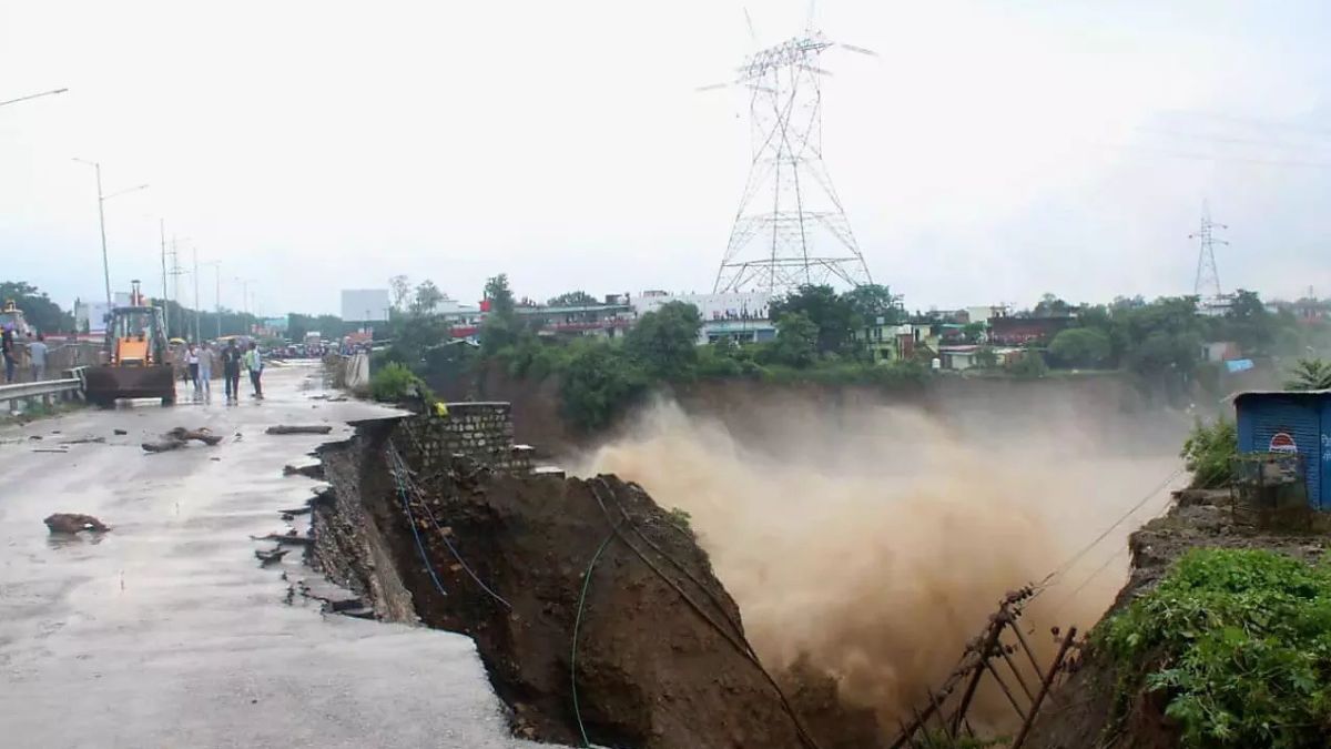
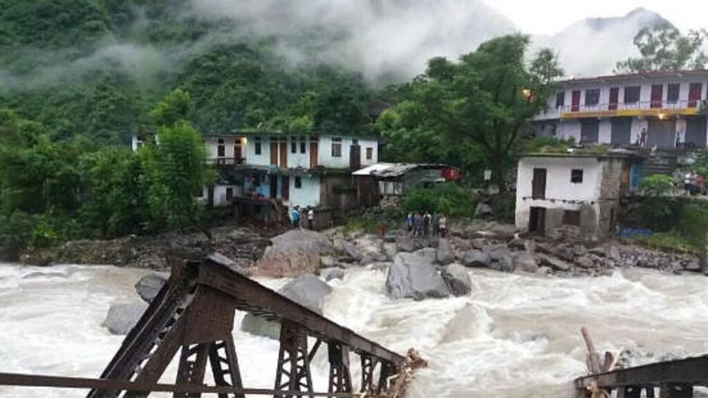
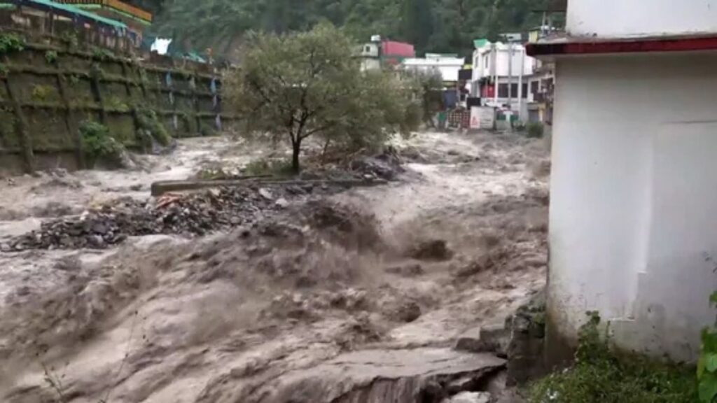
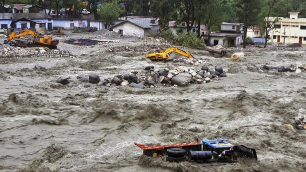
Late Monday night, Dehradun witnessed a sudden cloud of chaos — temple complexes and homes submerged, a 100-meter stretch of road swept away, and the Tamsa river turning rowdy, spilling its waters onto the streets. This wasn’t officially classified as a cloudburst, but the downpour was still exceptional.
Dr. Chander Singh Tomar, Head of the India Meteorological Centre in Dehradun, clarified in a telephonic interview that a cloudburst requires 100 mm or more rainfall in an hour, while Dehradun recorded 67 mm per hour. This makes it an “extreme and intense spell of rain,” though not technically a cloudburst.
The event caused flash floods across key city zones, disrupted traffic, and left several localities battling knee-deep water within minutes.
How Strong Winds and Air Mass Collisions Triggered the Rain Fury
Dr. Tomar explained that the root cause lies in the interaction of easterly and westerly winds — two opposing air masses clashing over the region. This atmospheric collision creates intense vertical movement of moisture-laden clouds, leading to heavy precipitation.
Such weather patterns are not unusual during the monsoon season, he noted, and an orange alert was already issued by the IMD, which remains in effect until September 17 at 8:30 AM. Heavy to very heavy rainfall is predicted in Dehradun, Nainital, and Champawat, while Chamoli, Udham Singh Nagar, Bageshwar, and Pithoragarh are also on the radar.
Climate Change Intensifying Extreme Rainfall Events
While the IMD sees this as a seasonal weather interaction, experts warn of a climate change connection.
Professor Yaspal Sundriyal, former Head of Geology at HNB Garhwal University, highlighted that cold, warm, and occluded air masses are increasingly colliding, forming what he called a “triple junction.” This atmospheric phenomenon is known to generate strong winds, heavy thunderstorms, and intense precipitation.
He added that climate change is shifting the rainfall pattern — although total rainfall might be declining, extreme rainfall events are increasing. Instead of receiving moderate rainfall spread across four to five days, the region is now experiencing the same amount of rain in just eight to ten hours, leading to flash floods and landslides.
Forest Fires and Black Carbon’s Role
Professor Sundriyal also pointed to the impact of forest fires, which release black carbon and nuclides. These particles mix with clouds, altering their behavior and sometimes triggering cloudbursts. While this year saw fewer forest fires, their lingering effects on cloud formation cannot be ignored.
Preparing for the Future
This alarming event underscores the urgent need for climate-resilient infrastructure, advanced early warning systems, and sustainable urban planning in Himalayan cities like Dehradun. As the monsoon rainfall in Uttarakhand has already exceeded the normal by 22% this year, the region must adapt to handle sudden weather shocks without human and economic loss.
Final Thoughts
The Dehradun rain fury wasn’t just another spell of bad weather — it was a stark reminder that climate change and strong winds are reshaping our monsoon patterns. As extreme events become more frequent, awareness and preparedness are key to protecting lives and livelihoods.
Note: All information and images used in this content are sourced from Google. They are used here for informational and illustrative purposes only.
Frequently Asked Questions (FAQ) About the Rain Fury in Dehradun
Q1. What caused the sudden heavy rainfall in Dehradun?
The heavy rainfall in Dehradun was caused by the interaction between easterly and westerly wind systems. When these opposite air masses collided over the region, they triggered intense cloud formation and heavy precipitation.
Q2. Was the recent rain in Dehradun a cloudburst?
No, it was not officially a cloudburst. According to the India Meteorological Department (IMD), a cloudburst is defined as rainfall of 100 mm or more in an hour. Dehradun recorded 67 mm per hour, which is considered an extreme spell of rain but not a cloudburst.
Q3. Why is this rainfall being linked to climate change?
Experts believe climate change is intensifying extreme weather events. Warmer temperatures cause air masses to hold more moisture, and their collisions create sudden heavy rainfall, thunderstorms, and strong winds—like the recent spell seen in Dehradun.
Q4. What role do forest fires play in extreme rainfall?
Forest fires release black carbon and nuclides that mix with clouds, altering their behavior and sometimes increasing the risk of intense rain or cloudbursts. Although this year saw fewer forest fires, past episodes may still influence local climate patterns.
Q5. How much excess rainfall has Uttarakhand received this monsoon?
As of now, Uttarakhand has received about 1343.2 mm of rainfall since June 1, which is around 22% above the normal average of 1103.2 mm. Some districts, like Bageshwar, have seen extremely high surpluses—up to 239% above normal.
Q6. Are such variations in rainfall normal for the region?
Seasonal variations—both surplus and deficit—are common in monsoon rainfall patterns. However, what is concerning is the increase in intense, short-duration rainfall events that can cause flash floods and landslides.
Q7. How has the rainfall pattern changed over the years?
Studies suggest that while overall rainfall has declined slightly, extreme rainfall events are becoming more frequent. The same amount of rain that used to fall over four to five days now often falls in just eight to ten hours, increasing the risk of sudden flooding.
Q8. What precautions are being taken currently?
The IMD has issued an orange alert for heavy rainfall in Dehradun, Nainital, Champawat, Chamoli, Udham Singh Nagar, Bageshwar, and Pithoragarh. Authorities are monitoring river levels, issuing warnings, and preparing emergency response teams to handle any flash floods or landslides.


Leave a Reply